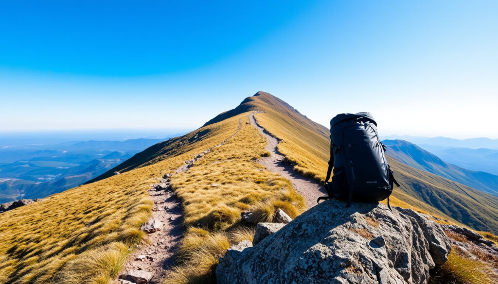
Ben Lomond Hike: Beginner’s Guide to Route and Difficulty
There’s a moment on every Munro bagger’s list when the eye drifts south, past the giants of the Highlands, to a solitary peak watching over Loch Lomond. That mountain is Ben Lomond, and it draws roughly 30,000 people up its slopes each year — many of them first-timers wondering if they’re ready for the challenge.
Height: 974 meters (3,196 feet) ·
Classification: Munro (mountains over 3,000 feet) ·
Location: Eastern shore of Loch Lomond, Loch Lomond and The Trossachs National Park ·
Annual Summit Attempts: Approximately 30,000 ·
First Recorded Ascent: 19th century (popularized by Victorian tourism)
Quick snapshot
- Ben Lomond is the most southerly Munro at 974 meters (National Trust for Scotland)
- The standard route from Rowardennan is about 7 miles (11 km) round trip (National Trust for Scotland)
- The mountain became a popular tourist destination in the 19th century with Victorian-era visitors (Wikipedia). The Ardess Hidden History Trail offers a low-level alternative (National Trust for Scotland)
- Check the Met Office (UK national weather service) forecast before planning your ascent
- Winter climbs require ice axe and crampons (Cameron House)
Let’s break down the key facts about Ben Lomond.
| Key facts | Value |
|---|---|
| Height in meters | 974 |
| Height in feet | 3,196 |
| Type | Munro |
| Location | Loch Lomond and The Trossachs National Park |
| Route length (standard) | 7 miles (11 km) round trip |
| Ascent time | 4-6 hours |
Can a Beginner Climb Ben Lomond?
The short answer: yes, with preparation. The National Trust for Scotland labels the Ben Lomond walk difficulty as “Hard,” but most people take 2½ to 4 hours to reach the summit and 4 to 6 hours for the full round trip (National Trust for Scotland (official conservation charity)). That’s a substantial mountain day, not a casual stroll.
What is the standard route to the summit?
- The standard route starts from the Rowardennan car park on the eastern shore of Loch Lomond (National Trust for Scotland)
- The tourist path is well-defined and clear, often described as an easy 1/5 difficulty route by climbing apps (Munros.app (Munro climbing database))
- The trail is about 7 miles (11 km) round trip with nearly 1,000 meters of vertical ascent (Ultra Light Hike (trekking guide))
- Start at the Rowardennan car park on the eastern shore of Loch Lomond.
- Follow the well-defined tourist path.
- Ascend the 7-mile round trip with nearly 1,000 meters of vertical ascent.
- Reach the summit at 974 meters.
- Descend the same route back to Rowardennan.
What fitness level is required for the Ben Lomond hike?
One guide describes Ben Lomond as “challenging in the right way rather than overwhelming” for walkers used to uphill climbs (Hiking with Lee (outdoor route guide)). Another warns it’s one of the harder Munros for unprepared novices despite the clear path (Cameron House). The consensus: a reasonable fitness level, some prior hiking experience, and a clear day are the minimum requirements.
For a reasonably fit beginner, Ben Lomond is a realistic first Munro — but only if you respect the ascent. The mountain demands a full day, proper boots, and weather awareness, not just enthusiasm.
What should I wear and bring for the climb?
- Layers are essential — the summit can be 5-10°C colder than at the base
- Waterproof jacket and trousers are non-negotiable; Scottish mountain weather changes quickly
- Sturdy hiking boots with good grip for the rocky upper sections
- Map, compass, and navigation skills — the path is clear but mist can reduce visibility to meters
The pattern is consistent across sources: Ben Lomond is accessible but not easy. The implication for first-timers is to train with shorter hill walks, check the forecast, and start early.
Is Ben Nevis Harder than Ben Lomond?
Yes — significantly. Ben Nevis towers at 1,345 meters, making it the highest mountain in the British Isles. Ben Lomond’s 974 meters sit nearly 400 meters lower, which translates to a shorter ascent and generally less technical terrain.
What is the height difference between Ben Lomond and Ben Nevis?
Six data points, one pattern: Ben Nevis demands more of everything. At 1,345 meters (Wikipedia (encyclopedic reference)), it’s 371 meters higher than Ben Lomond. That extra height means more ascent, longer exposure to weather, and a more demanding overall climb.
Which mountain is better for a first Munro?
- Ben Lomond is widely recommended as a first Munro because of its well-defined path and shorter round trip (National Trust for Scotland)
- Ben Nevis requires significant experience and navigation skills, especially in poor weather (Wikipedia)
- The Ben Lomond route is often described as moderate with clear paths suitable for basic fitness levels (Hiking with Lee)
Here is a direct comparison between the two mountains.
| Comparison | Ben Lomond | Ben Nevis |
|---|---|---|
| Height | 974 meters | 1,345 meters |
| Classification | Munro | Munro (highest in UK) |
| Technical difficulty | Non-technical, clear path | Requires navigation skills |
| Round trip time | 4-6 hours | 7-9 hours |
| Suitability for beginners | Yes, with fitness | No — experienced only |
The catch: Ben Lomond’s beginner-friendly reputation can lull hikers into underestimating it. The mountain still demands almost 1,000 meters of vertical gain, and unprepared walkers will feel it.
Why Is It Called Ben Lomond?
The name reveals the mountain’s history and function in Gaelic Scotland.
What does “Ben” mean in Scottish place names?
“Ben” comes from the Gaelic “beinn,” meaning mountain (Wikipedia). It’s the same root you see across Scotland — Ben Nevis, Ben Macdui, and dozens more.
What is the origin of the name “Lomond”?
- The most accepted theory links “Lomond” to the Gaelic “láom,” meaning beacon or lighthouse
- Another theory suggests “leamhan,” meaning elm tree
- The beacon interpretation is plausible because the mountain may have hosted signal fires (Wikipedia)
The trade-off: the beacon theory is romantic, but the elm theory has linguistic support. Either way, the name predates the Victorian hiking era by centuries, marking the mountain as a landmark long before it became a tourist destination.
What Is the Connection Between Ben Lomond and the Song “You Take the High Road”?
The song in question is “The Bonnie Banks o’ Loch Lomond,” a traditional Scottish folk song that mentions the mountain by name (Wikipedia (encyclopedic reference)).
What is the most famous Scottish song of all time?
“The Bonnie Banks o’ Loch Lomond” is certainly in the conversation. The song’s chorus references the high road and the low road, and its lyrics tell of two lovers parting — one possibly facing execution, taking the low road (the path of the dead) home (Wikipedia).
What does “take a load off fanny” mean in the song “The Weight”?
That’s a different song entirely. “The Weight” by The Band is an American folk-rock tune unrelated to Scottish mountain lore (Wikipedia). Its famously ambiguous line about “Fanny” has been interpreted as a reference to biblical figures or a character from a film — but it has nothing to do with Loch Lomond.
The song that made Ben Lomond famous is about separation and loss, not triumph. Hikers who hum the tune on the way up are walking in the footsteps of a story about someone who never made it home — a reminder that mountains demand respect.
The implication is clear: the mountain’s cultural weight adds to the experience, but the physical challenge remains the priority.
What Is the Weather Like on Ben Lomond?
Weather is the great equalizer on Ben Lomond — it can turn a moderate hike into a survival test.
How can I check the Ben Lomond mountain weather forecast?
- The Met Office (UK national weather service) provides mountain-specific forecasts
- The Mountain Weather Information Service (specialist mountain forecast) offers detailed summit conditions
- Always check both before setting out — conditions can change within hours
What are the typical weather conditions in different seasons?
Here is a seasonal breakdown of the weather conditions.
| Season | Conditions | Recommendation |
|---|---|---|
| May-September | Mildest, longest daylight | Safest window for beginners |
| October-April | Snow, ice, high winds | Requires winter gear and experience |
| Year-round | Rapid changes, summit 5-10°C colder | Always carry layers and waterproofs |
The National Trust for Scotland labels the walk “Hard,” and that rating isn’t just about ascent — it’s about exposure. Winter climbs on Ben Lomond demand ice axe and crampons, and the Cameron House guide explicitly recommends “a reasonable level of fitness, some prior hiking experience, and a clear day for safety” (Cameron House).
For hikers who aren’t ready for the summit, the Ardess Hidden History Trail near Ben Lomond is a low-level walk for all ages and fitness levels — an easier alternative that still gets you into the landscape (National Trust for Scotland). The trade-off is clear: you miss the summit views, but you gain a walk you can actually enjoy.
Confirmed facts
- Ben Lomond is the most southerly Munro in Scotland (National Trust for Scotland)
- The mountain is 974 meters high (Wikipedia)
- The standard route starts from Rowardennan (National Trust for Scotland)
- The song “The Bonnie Banks o’ Loch Lomond” is associated with the area (Wikipedia)
- Most people take 2½-4 hours to reach the summit (National Trust for Scotland)
What’s unclear
- The exact etymology of “Lomond” — “beacon” vs. “elm tree” — remains debated (Wikipedia)
- The specific interpretation of “the low road” in the song is folkloric, not definitively proven (Wikipedia)
- First recorded ascent date is not precisely documented — the mountain was popularized in the 19th century (Wikipedia)
What Hikers Say
Most people take 2½ to 4 hours to reach the summit and 4 to 6 hours for the full up-and-down trip, depending on fitness and pace.
— National Trust for Scotland (official conservation charity)
Ben Lomond is one of the harder Munros for new hikers if they are unprepared, despite a well-defined path.
Ben Lomond is challenging in the right way rather than overwhelming for reasonably fit walkers used to uphill walking.
For beginner hikers, the choice between Ben Lomond and Ben Nevis is not about which mountain is “better” — it’s about which one will have you walking down with a smile instead of a rescue helicopter. Ben Lomond offers the full Munro experience: the ascent, the summit, the song, and the sense of achievement, at a scale that rewards preparation rather than punishing its absence. For anyone planning their first Scottish mountain day, the mountain itself is the answer: train for the vertical gain, check the forecast, and the low road will take you home safely.
reddit.com, buzzlayer.org, digitaltravelcouple.com, trailrunmag.com, onxmaps.com, thatraveller.com
Frequently asked questions
Is Ben Lomond a Munro?
Yes, Ben Lomond is a Munro — a Scottish mountain over 3,000 feet (914 meters). At 974 meters, it qualifies comfortably and is the most southerly Munro in Scotland (National Trust for Scotland).
Where is the Ben Lomond trailhead?
The standard route starts at the Rowardennan car park on the eastern shore of Loch Lomond. The trailhead is accessible via the West Highland Way, and parking is paid (National Trust for Scotland).
Can you climb Ben Lomond in winter?
Yes, but winter conditions from roughly November to April can make the mountain dangerous. Ice axe and crampons are essential, along with winter navigation skills. The National Trust for Scotland advises checking conditions carefully and being prepared for severe weather (Cameron House).
Are dogs allowed on Ben Lomond?
Yes, dogs are welcome on the Ben Lomond path, but the National Trust for Scotland asks that they be kept under close control, especially near livestock. There are also seasonal restrictions in some areas to protect ground-nesting birds. Check the National Trust for Scotland planning page for current guidance.
What is the nearest town to Ben Lomond?
Balloch, at the southern end of Loch Lomond, is the main access town with train connections from Glasgow. The Rowardennan car park is about 25 minutes north of Balloch by road (National Trust for Scotland).
How difficult is the Ben Lomond hike?
The National Trust for Scotland rates it “Hard.” The route involves nearly 1,000 meters of ascent over about 7 miles (11 km). For the average fit hiker, it’s a demanding but achievable day; for someone who hasn’t trained, it will be a struggle (Ultra Light Hike).
Related reading
- How to Choose the Best Ski Jacket: A Complete Buying Guide — essential gear knowledge for mountain hikes
- Healthy Snacks: Top 5, Filling Options, and Budget Picks — energy for the ascent
More related posts
 Samuel Pepys: His Diary, Great Fire, and Queen Kiss
 Maia Mitchell: Biography, Relationships, Career & Now
 Kevin Bridges 2026 Tour: Dates, Celtic Support, Personal Life
 Disneyland Paris Hotels: Walk Times, Costs & Value
 AJ Bell Login: Secure Access to Your Investments
 Missy Peregrym: From Rookie Blue to FBI — The Actress Behind Special Agent Maggie Bell
 Lisa Tarbuck: Why She Left BBC Radio 2, Beard & Net Worth
 Statutory Sick Pay Ireland 2026: Rates & How to Claim